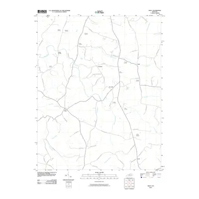
2010 Map of Tracy
USGS Topo · Published 2010About this map
Tracy and the surrounding Barren County countryside are defined by a network of rural roads and scattered family burial grounds. This landscape is shaped by the winding course of Peter Creek and its many tributaries, including Caney Fork and Dry Fork. Small settlements such as Cooktown, Etoile, and Lamb are linked by a dense web of local routes like Tracy Antioch Rd and Mount Zion Rd, indicating a long-established community structure centered on land ownership and family heritage. Genealogists will find a wealth of records in the numerous small plots scattered throughout the area, from the Kinslow Cemetery in the north to the Antioch Church Cemetery further south. The map reflects a predominantly agricultural character, where names like Payne Mill Rd and Woods Store Rd suggest a history of local commerce and early industrial processing along the creek beds.
Find a feature on this map
66 named features on this map. Tap any name to fly to it.
Don’t see what you’re looking for? This feature index may not catch every label — zoom into the map to look around manually.
Map Details
Editions of this 2010 Tracy Map
This is the sole edition of this map. No revisions or reprints were ever made.
Other maps of this area

1926 · Scottsville
USGS Topo · 1:62,500

1931 · Lafayette
USGS Topo · 1:62,500

1931 · Red Boiling Springs
USGS Topo · 1:62,500

1953 · Tracy
USGS Topo · 1:24,000

1953 · Temple Hill
USGS Topo · 1:24,000

1953 · Glasgow South
USGS Topo · 1:24,000

1953 · Freedom
USGS Topo · 1:24,000

1954 · Austin
USGS Topo · 1:24,000

1954 · Fountain Run
USGS Topo · 1:24,000

1954 · Gamaliel
USGS Topo · 1:24,000