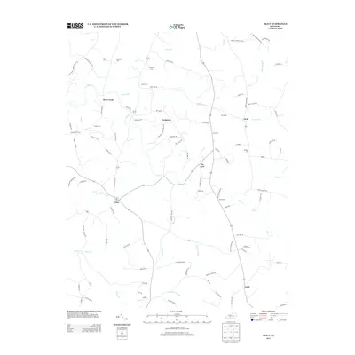
2013 Map of Tracy
USGS Topo · Published 2013About this map
The agrarian communities of southern Kentucky are centered here around the crossroads of Tracy and Dry Fork. This 2013 landscape is deeply rooted in local family history, as evidenced by a high density of small family and community burial grounds, including Kinslow Cem, Bradshaw Cem, and the Antioch Church Cem. The terrain is defined by a network of winding creeks and branches, such as Caney Fork, Peter Cr, and Indian Camp Br, which historically shaped the placement of farmsteads and the winding paths of roads like Cooktown Rd. While the area remains largely rural, Adair Airport near the southern boundary and the small clusters at Cooktown, Etoile, and Lamb signify the enduring settlement patterns of this corner of Barren County. The map provides a detailed view of the local road network, from named school roads to the primary route connecting these small Kentucky hamlets.
Find a feature on this map
95 named features on this map. Tap any name to fly to it.
Don’t see what you’re looking for? This feature index may not catch every label — zoom into the map to look around manually.
Map Details
Editions of this 2013 Tracy Map
This is the sole edition of this map. No revisions or reprints were ever made.
Other maps of this area

1926 · Scottsville
USGS Topo · 1:62,500

1931 · Lafayette
USGS Topo · 1:62,500

1931 · Red Boiling Springs
USGS Topo · 1:62,500

1953 · Tracy
USGS Topo · 1:24,000

1953 · Temple Hill
USGS Topo · 1:24,000

1953 · Glasgow South
USGS Topo · 1:24,000

1953 · Freedom
USGS Topo · 1:24,000

1954 · Austin
USGS Topo · 1:24,000

1954 · Fountain Run
USGS Topo · 1:24,000

1954 · Gamaliel
USGS Topo · 1:24,000