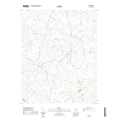
2019 Map of Tracy
USGS Topo · Published 2019About this map
Peter Creek and Dry Fork flow through this section of Barren County, where a network of rural roads connects several small communities and family burial grounds. The settlement of Tracy sits at a crossroads near Eubank Field, serving as a central point between neighbors like Cooktown, Etoile, and Lamb. The landscape is defined by its numerous small cemeteries, such as Kinslow Cem and Bradshaw Cem, which are often situated on hillsides overlooking the creek valleys. Many of these sites, including the Antioch Church-Cem near the Monroe County line, provide critical geographic markers for researchers tracing local lineage. The presence of Adair Airport near the southern boundary along Austin Tracy Rd adds a mid-century transportation element to this primarily agricultural and residential corridor.
Find a feature on this map
94 named features on this map. Tap any name to fly to it.
Don’t see what you’re looking for? This feature index may not catch every label — zoom into the map to look around manually.
Map Details
Editions of this 2019 Tracy Map
This is the sole edition of this map. No revisions or reprints were ever made.
Other maps of this area

1926 · Scottsville
USGS Topo · 1:62,500

1931 · Lafayette
USGS Topo · 1:62,500

1931 · Red Boiling Springs
USGS Topo · 1:62,500

1953 · Tracy
USGS Topo · 1:24,000

1953 · Temple Hill
USGS Topo · 1:24,000

1953 · Glasgow South
USGS Topo · 1:24,000

1953 · Freedom
USGS Topo · 1:24,000

1954 · Austin
USGS Topo · 1:24,000

1954 · Fountain Run
USGS Topo · 1:24,000

1954 · Gamaliel
USGS Topo · 1:24,000