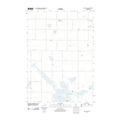
2010 Map of Tracy West
USGS Topo · Published 2010About this map
The interconnected waters of Lake Shetek, Bloody Lake, and Fremont Lake dominate the southern portion of this landscape, forming a complex lacustrine network that defines the region's geography. This area, located northwest of the small settlement of Owanka, shows a transition from permanent open water to reclaimed prairie land, evidenced by the presence of the Sigel Lakebed and Jim Lakebed to the east. These lakebeds suggest a historical shift in local hydrology or intentional drainage for agricultural use, which now surrounds these former water bodies with a strict grid of county roads and avenues.
Find a feature on this map
44 named features on this map. Tap any name to fly to it.
Don’t see what you’re looking for? This feature index may not catch every label — zoom into the map to look around manually.
Map Details
Editions of this 2010 Tracy West Map
This is the sole edition of this map. No revisions or reprints were ever made.
Other maps of this area

1953 · New Ulm
USGS Topo · 1:250,000

1957 · New Ulm
USGS Topo · 1:250,000

1958 · New Ulm
USGS Topo · 1:250,000

1962 · Milroy SE
USGS Topo · 1:24,000

1962 · Amiret
USGS Topo · 1:24,000

1963 · Marshall SE
USGS Topo · 1:24,000

1967 · New Ulm
USGS Topo · 1:250,000

1967 · Balaton
USGS Topo · 1:24,000

1967 · Tracy East
USGS Topo · 1:24,000

1967 · Hadley
USGS Topo · 1:24,000