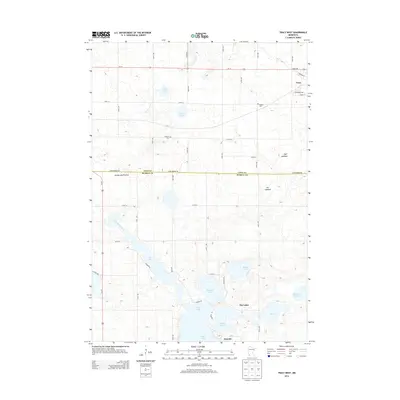
2013 Map of Tracy West
USGS Topo · Published 2013About this map
The Coteau des Prairies plateau shapes the hydrology of this southwestern Minnesota landscape, where the headwaters of the Des Moines River begin their journey. The boundary between Lyon Co and Murray Co bisects a region characterized by numerous glacial lakes and basins, including Shetek Lake, Bloody Lake, and Fremont Lake. In the northern portion, the city of Tracy sits along Us-14, serving as a local hub. Further south, the map reveals smaller clusters like The Lakes and Owanka, indicating the development of lakeside communities. Genealogists and local historians can find rural landmarks such as Holland Cem and Rialson Cem, while the existence of the Sigel Lakebed and Jim Lakebed suggests shifts in the local water table and land use over time.
Find a feature on this map
35 named features on this map. Tap any name to fly to it.
Don’t see what you’re looking for? This feature index may not catch every label — zoom into the map to look around manually.
Map Details
Editions of this 2013 Tracy West Map
This is the sole edition of this map. No revisions or reprints were ever made.
Other maps of this area

1953 · New Ulm
USGS Topo · 1:250,000

1957 · New Ulm
USGS Topo · 1:250,000

1958 · New Ulm
USGS Topo · 1:250,000

1962 · Milroy SE
USGS Topo · 1:24,000

1962 · Amiret
USGS Topo · 1:24,000

1963 · Marshall SE
USGS Topo · 1:24,000

1967 · New Ulm
USGS Topo · 1:250,000

1967 · Balaton
USGS Topo · 1:24,000

1967 · Tracy East
USGS Topo · 1:24,000

1967 · Hadley
USGS Topo · 1:24,000