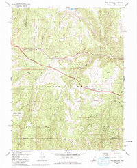
1981 Map of Trail Mountain
USGS Topo · Published 1991About this map
Fishlake National Forest dominates this topographic survey, revealing a landscape defined by sharp elevation changes and high mountain drainage systems. Deep canyons such as Clear Creek Canyon and Snow Canyon cut through the terrain, while landmarks like Trail Mountain and Big Bench offer prominent navigational points. The map documents an area where water management and transportation were central to local activity, evidenced by the Three Creeks Reservoir and a network of named streams including Serviceberry Creek and Rosebud Creek.
Find a feature on this map
47 named features on this map. Tap any name to fly to it.
Don’t see what you’re looking for? This feature index may not catch every label — zoom into the map to look around manually.
Map Details
Editions of this 1981 Trail Mountain Map
2 editions found
Other maps of this area

1885 · Beaver
USGS Topo · 1:250,000

1932 · Sevier
USGS Topo · 1:62,500

1935 · Sevier
USGS Topo · 1:62,500

1937 · Delano Peak
USGS Topo · 1:48,000

1943 · Delano Peak
USGS Topo · 1:62,500

1953 · Richfield
USGS Topo · 1:250,000

1954 · Beaver NE
USGS Topo · 1:24,000

1958 · Richfield
USGS Topo · 1:250,000

1958 · Beaver
USGS Topo · 1:62,500

1962 · Cove Fort
USGS Topo · 1:62,500