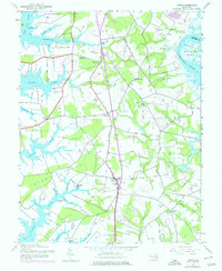
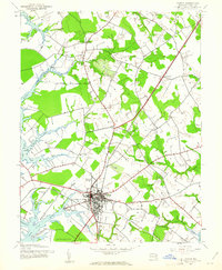
1942 Map of Trappe
USGS Topo · Published 1976About this map
Trappe and its surrounding agricultural necks dominate this coastal Maryland landscape, situated between the Tred Avon River and the Choptank River. The settlement pattern follows the peninsula's geography, with small communities like Stumptown, Hambleton, and Manadier linked by a road network that branches toward numerous water-bound points. Local heritage is preserved through markers such as the Union Church and Merrick Cemetery, while the Trappe Station label indicates the historical path of the railroad through Oxford Neck.
Find a feature on this map
45 named features on this map. Tap any name to fly to it.
Don’t see what you’re looking for? This feature index may not catch every label — zoom into the map to look around manually.
Map Details
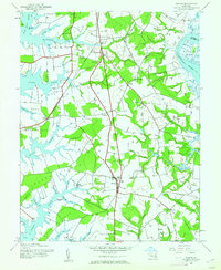
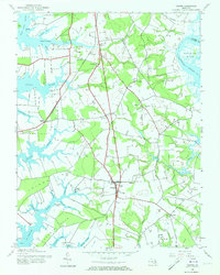
Editions of this 1942 Trappe Map
3 editions found
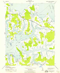
Other maps of this area

1898 · Choptank
USGS Topo · 1:125,000

1904 · St. Michaels
USGS Topo · 1:62,500

1904 · Oxford
USGS Topo · 1:62,500

1905 · Denton
USGS Topo · 1:62,500

1905 · Hurlock
USGS Topo · 1:62,500

1908 · Choptank
USGS Topo · 1:125,000

1942 · Oxford
USGS Topo · 1:31,680
1942 · Church Creek
USGS Topo · 1:24,000
1942 · Easton
USGS Topo · 1:24,000
1942 · St. Michaels
USGS Topo · 1:24,000