
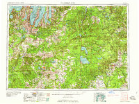
1958 Map of Traverse City
USGS Topo · Published 1958About this map
Lake Michigan and the distinctive dual inlets of Grand Traverse Bay dominate this mid-century survey of Northern Lower Michigan. The region is characterized by its post-lumbering transition into a premier recreational and military landscape, anchored by the Michigan National Guard Military Reserve and sprawling tracts like the Au Sable State Forest and Huron National Forest. Hubs of commerce and transport such as Traverse City, Cadillac, and Grayling are shown at a point of significant growth, connected by a robust rail network including the Chesapeake and Ohio RR and Pennsylvania RR.
Find a feature on this map
165 named features on this map. Tap any name to fly to it.
Don’t see what you’re looking for? This feature index may not catch every label — zoom into the map to look around manually.
Map Details
Editions of this 1958 Traverse City Map
2 editions found
Other maps of this area

1931 · Baldwin NW
USGS Topo · 1:31,680

1931 · Custer NE
USGS Topo · 1:31,680

1931 · Chase NE
USGS Topo · 1:31,680

1931 · Baldwin NE
USGS Topo · 1:31,680

1932 · Freesoil SE
USGS Topo · 1:31,680

1932 · Chase NW
USGS Topo · 1:31,680

1933 · Peacock SE
USGS Topo · 1:31,680

1933 · Peacock SW
USGS Topo · 1:31,680

1933 · Luther SE
USGS Topo · 1:31,680

1933 · Peacock NE
USGS Topo · 1:31,680
Featured Places
- Garfield Township, MI
- Garfield Charter Township, Garfield Township
- Traverse City, MI
- East Bay Township, MI
- East Bay Charter Township, East Bay Township