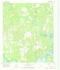
1962 Map of Trees
USGS Topo · Published 1975About this map
Trees and its surrounding oil and gas fields define the borderlands of northeast Texas and northwest Louisiana in the early 1960s. This survey captures the transition from the wetlands of Caddo Lake and Caddo Lake Bayou to the upland timber and oil fields of Marion County and Caddo Parish. Settlements like Monterey and Gray are shown alongside active industrial sites, including numerous Oil Wells and a Gas Well that speak to the region's mid-century energy production.
Find a feature on this map
37 named features on this map. Tap any name to fly to it.
Don’t see what you’re looking for? This feature index may not catch every label — zoom into the map to look around manually.
Map Details
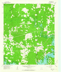
Editions of this 1962 Trees Map
2 editions found
Other maps of this area

1932 · Hosston NW
USGS Topo · 1:31,680

1932 · Hosston SW
USGS Topo · 1:31,680

1944 · Kildare
USGS Topo · 1:62,500

1944 · Caddo Lake
USGS Topo · 1:62,500

1946 · Caddo Lake
USGS Topo · 1:62,500

1948 · Kildare
USGS Topo · 1:62,500

1948 · Mooringsport
USGS Topo · 1:62,500

1948 · Vivian
USGS Topo · 1:62,500

1955 · Shreveport
USGS Topo · 1:250,000

1955 · Mooringsport
USGS Topo · 1:62,500