
1961 Map of Tremonton
USGS Topo · Published 1963About this map
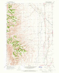
The Malad River and Bear River converge in this fertile valley of northern Utah, where irrigation and agriculture have long shaped the landscape. In the early 1960s, Tremonton served as a central hub, flanked by smaller communities like Garland, Bothwell, and Elwood. The infrastructure of the era is clearly visible, from the Tremonton Municipal Airport and a Drive-in Theater to the Union Pacific railroad lines that facilitated regional trade.
Find a feature on this map
37 named features on this map. Tap any name to fly to it.
Don’t see what you’re looking for? This feature index may not catch every label — zoom into the map to look around manually.
Map Details
Editions of this 1961 Tremonton Map
This is the sole edition of this map. No revisions or reprints were ever made.
Other maps of this area

1954 · Public Shooting Grounds
USGS Topo · 1:24,000

1954 · Brigham City
USGS Topo · 1:250,000

1955 · Bear River City
USGS Topo · 1:24,000

1955 · Brigham City
USGS Topo · 1:24,000

1958 · Brigham City
USGS Topo · 1:250,000

1961 · Thatcher Mountain
USGS Topo · 1:62,500

1961 · Honeyville
USGS Topo · 1:24,000

1962 · Brigham City
USGS Topo · 1:250,000
1964 · Riverside
USGS Topo · 1:24,000
1964 · Cutler Dam
USGS Topo · 1:24,000