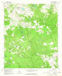
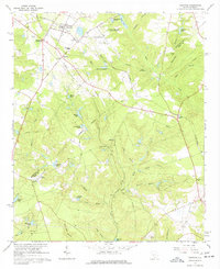
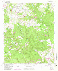
1964 Map of Trenton
USGS Topo · Published 1965About this map
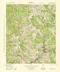
The Southern rail line cuts diagonally through the heart of the South Carolina backcountry, anchoring the town of Trenton and smaller outposts like Pine House Crossroads and Eureka. This mid-century landscape is defined by its agrarian infrastructure and educational history, notably featuring the Bettis Academy campus near the Aiken CO border. The map documents an extensive network of named family ponds and water bodies, including Harrison Pond, Mathis Pond, and Simons Lake, which supported the local rural economy alongside the Trenton Municipal Airport. Cultural markers are densely plotted, from the Ebenezer Ch to various family burial grounds like Busbee Cem and Wicker Cem. The presence of the Ridge Nursery (State Forest) and numerous claypits indicates a landscape active with forestry and small-scale resource extraction. Historical transport routes like Plank Road and Old Plank Road suggest older patterns of commerce that predated the modern highway system.
Find a feature on this map
49 named features on this map. Tap any name to fly to it.
Don’t see what you’re looking for? This feature index may not catch every label — zoom into the map to look around manually.
Map Details
Editions of this 1964 Trenton Map
Other maps of this area

1920 · Aiken
USGS Topo · 1:48,000

1921 · Aiken
USGS Topo · 1:62,500

1923 · Warrenville
USGS Topo · 1:48,000

1928 · Warrenville
USGS Topo · 1:62,500
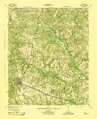
1943 · Aiken
USGS Topo · 1:62,500
1943 · Warrenville
USGS Topo · 1:62,500

1954 · Augusta
USGS Topo · 1:250,000

1957 · Augusta
USGS Topo · 1:250,000

1958 · Augusta
USGS Topo · 1:250,000

1961 · Augusta
USGS Topo · 1:250,000