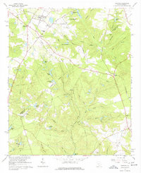
1964 Map of Trenton
USGS Topo · Published 1977About this map
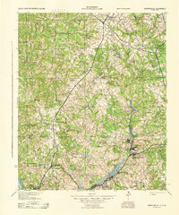
Trenton anchors the northern portion of this landscape, serving as a hub where the Southern railroad intersects several regional thoroughfares. The 1960s terrain is marked by a transition from organized agricultural and municipal features, such as the Trenton Municipal Airport and the State Forest Nursery, to a complex network of creeks and branches. Evidence of local industry and social infrastructure is scattered throughout, including multiple Claypit sites and the historic campus of Bettis Academy. Numerous rural congregations and family burial grounds, such as Ebenezer Ch and the Busbee Cem, are connected by established routes like the Old Plank Road. As the land slopes southward toward the Edgefield Co Aiken Co line, the geography becomes defined by its water system, specifically the numerous named basins including Harrison Pond, Mathis Pond, and Simons Lake which feed into Horse Creek.
Find a feature on this map
53 named features on this map. Tap any name to fly to it.
Don’t see what you’re looking for? This feature index may not catch every label — zoom into the map to look around manually.
Map Details
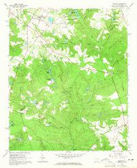
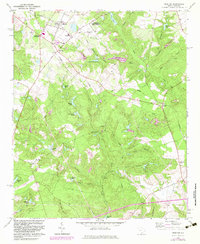
Editions of this 1964 Trenton Map
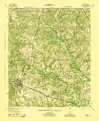
Other maps of this area

1920 · Aiken
USGS Topo · 1:48,000

1921 · Aiken
USGS Topo · 1:62,500

1923 · Warrenville
USGS Topo · 1:48,000

1928 · Warrenville
USGS Topo · 1:62,500
1943 · Aiken
USGS Topo · 1:62,500
1943 · Warrenville
USGS Topo · 1:62,500

1954 · Augusta
USGS Topo · 1:250,000

1957 · Augusta
USGS Topo · 1:250,000

1958 · Augusta
USGS Topo · 1:250,000

1961 · Augusta
USGS Topo · 1:250,000