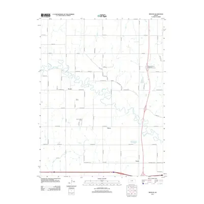
2012 Map of Trenton
USGS Topo · Published 2012About this map
The Saline River carves a winding path through this portion of Ottawa and Saline counties, defining the rural character of the settlements at Marydel and Shipton. This 2012 survey illustrates a landscape of agricultural sections and family-named landmarks, anchored by the Saline County State Lake in the southeast. For genealogists and local historians, the map provides precise locations for several regional burial grounds, including Crown Point Cem near the river bluffs, Walnut Hill Cem further south, and Shiloh Cem near the community of Trenton. The geography is further marked by the Burger's Valley Airport and several small water bodies like Wary Lake, showing the modern infrastructure and natural drainage patterns of this Kansas river valley.
Find a feature on this map
59 named features on this map. Tap any name to fly to it.
Don’t see what you’re looking for? This feature index may not catch every label — zoom into the map to look around manually.
Map Details
Editions of this 2012 Trenton Map
This is the sole edition of this map. No revisions or reprints were ever made.
Other maps of this area

1892 · Salina
USGS Topo · 1:125,000

1892 · Minneapolis
USGS Topo · 1:125,000

1942 · Salina
USGS Topo · 1:125,000

1955 · Salina
USGS Topo · 1:24,000

1955 · Salina SW
USGS Topo · 1:24,000

1955 · Trenton
USGS Topo · 1:24,000

1955 · Brookville
USGS Topo · 1:24,000

1955 · Culver
USGS Topo · 1:24,000

1955 · New Cambria
USGS Topo · 1:24,000

1955 · Manhattan
USGS Topo · 1:250,000