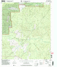
2004 Map of Trevat
USGS Topo · Published 2006About this map
Davy Crockett National Forest dominates the northwestern portion of this East Texas landscape, where the managed timberlands of the Piney Woods meet the winding tributaries of Piney Creek. This area, updated in the early 2000s, reveals a rural network of logging tracks and service routes like Woods Road, supporting a local economy historically tied to forestry and small-scale resource extraction, as evidenced by a Gravel Pit near the forest boundary.
Find a feature on this map
27 named features on this map. Tap any name to fly to it.
Don’t see what you’re looking for? This feature index may not catch every label — zoom into the map to look around manually.
Map Details
Editions of this 2004 Trevat Map
This is the sole edition of this map. No revisions or reprints were ever made.
Other maps of this area

1953 · Palestine
USGS Topo · 1:250,000

1954 · Beaumont
USGS Topo · 1:250,000

1955 · New Willard
USGS Topo · 1:62,500

1957 · Beaumont
USGS Topo · 1:250,000

1957 · Palestine
USGS Topo · 1:250,000

1960 · Colita
USGS Topo · 1:24,000

1963 · Crecy
USGS Topo · 1:24,000

1963 · Groveton East
USGS Topo · 1:24,000
1963 · Apple Springs
USGS Topo · 1:24,000
1963 · Diboll
USGS Topo · 1:24,000