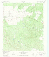
1967 Map of Triangle Ranch
USGS Topo · Published 1981About this map
Triangle Ranch occupies a significant portion of this West Texas landscape, straddling the border between Cottle and Foard Counties. The area is characterized by a network of ranching infrastructure, where water management is paramount, as evidenced by numerous named reservoirs like Matador Tank, Rock Tank, and Charley Hart Tank. The 1979 revisions, shown in purple, highlight the development of a Landing Strip and various windmills, including the Cactus Flats Windmill and Oil Well Windmill, which were essential for sustaining livestock and operations in this semi-arid environment.
Find a feature on this map
25 named features on this map. Tap any name to fly to it.
Don’t see what you’re looking for? This feature index may not catch every label — zoom into the map to look around manually.
Map Details
Editions of this 1967 Triangle Ranch Map
2 editions found
Other maps of this area

1927 · Quanah 3-b
USGS Topo · 1:48,000

1932 · Vivian
USGS Topo · 1:62,500

1954 · Lubbock
USGS Topo · 1:250,000

1954 · Plainview
USGS Topo · 1:250,000

1954 · Wichita Falls
USGS Topo · 1:250,000

1955 · Lawton
USGS Topo · 1:250,000

1958 · Wichita Falls
USGS Topo · 1:250,000

1958 · Plainview
USGS Topo · 1:250,000

1960 · Teacup Mountain
USGS Topo · 1:62,500

1967 · Triangle Ranch
USGS Topo · 1:24,000