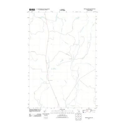
2011 Map of Triangle Ranch
USGS Topo · Published 2011About this map
Triangle Ranch serves as a central landmark in this Upper Peninsula landscape, where the headwaters of the Hemlock River and East Branch Net River drain the timbered terrain of Iron County. The drainage pattern is complex, featuring the confluence of the West Branch Hemlock River and East Branch Hemlock River near several named access points like Premo Dam Rd. Water remains the dominant geographic feature, with Spies Lake in the northeast and smaller bodies such as Twin Lakes and Poplar Ridge Lake scattered across the interior. Road names like The Grade and Railroad Creek hint at the area's industrial legacy of logging and transport. This 2011 survey captures the network of local routes, including Fishing Site No 1 Rd and Basilio Rd, which provide access to the creeks and marshes that define the local topography.
Find a feature on this map
26 named features on this map. Tap any name to fly to it.
Don’t see what you’re looking for? This feature index may not catch every label — zoom into the map to look around manually.
Map Details
Editions of this 2011 Triangle Ranch Map
This is the sole edition of this map. No revisions or reprints were ever made.
Other maps of this area

1895 · Ned Lake
USGS Topo · 1:62,500

1895 · Perch Lake
USGS Topo · 1:62,500

1898 · Iron River
USGS Topo · 1:62,500

1899 · Crystal Falls
USGS Topo · 1:62,500

1945 · Sunset Lake
USGS Topo · 1:24,000

1945 · Kelso Junction
USGS Topo · 1:24,000

1945 · Amasa
USGS Topo · 1:24,000

1946 · Sunset Lake
USGS Topo · 1:31,680
1947 · Amasa
USGS Topo · 1:24,000

1947 · Kelso Junction
USGS Topo · 1:24,000