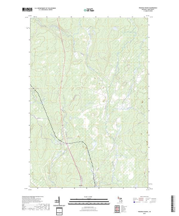
2023 Map of Triangle Ranch
USGS Topo · Published 2023About this map
Amasa serves as the primary point of reference in this Upper Peninsula landscape, where the headwaters of the Hemlock River and East Branch Net River drain a complex network of wetlands and wooded lowlands. The geography is defined by its industrial and recreational access, notably the Triangle Spur railroad line and a series of rural routes like Triangle Ranch Rd and Basilio Rd. Large water bodies such as Poplar Ridge Lake and Spies Lake anchor the interior, surrounded by a dense web of smaller tributaries including Stari Creek and Gilbert Creek.
Find a feature on this map
31 named features on this map. Tap any name to fly to it.
Don’t see what you’re looking for? This feature index may not catch every label — zoom into the map to look around manually.
Map Details
Editions of this 2023 Triangle Ranch Map
This is the sole edition of this map. No revisions or reprints were ever made.
Other maps of this area

1895 · Ned Lake
USGS Topo · 1:62,500

1895 · Perch Lake
USGS Topo · 1:62,500

1898 · Iron River
USGS Topo · 1:62,500

1899 · Crystal Falls
USGS Topo · 1:62,500

1945 · Sunset Lake
USGS Topo · 1:24,000

1945 · Kelso Junction
USGS Topo · 1:24,000

1945 · Amasa
USGS Topo · 1:24,000

1946 · Sunset Lake
USGS Topo · 1:31,680
1947 · Amasa
USGS Topo · 1:24,000

1947 · Kelso Junction
USGS Topo · 1:24,000