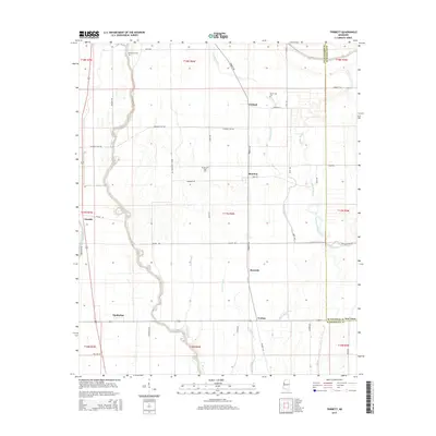
2015 Map of Tribbett
USGS Topo · Published 2015About this map
Bogue Phalia snakes through the heart of this Washington and Sunflower County landscape, defining the alluvial drainage patterns of the Mississippi Delta. The 2015 survey reveals a terrain dominated by agricultural efficiency, where long straight roads like Marta Plantation Rd and Kennedy Flat Rd grid the fertile land between waterways. Small communities and historical landing sites such as Tribbett, Bourbon, and Tralake are connected by this network, serving as focal points for the surrounding farms.
Find a feature on this map
54 named features on this map. Tap any name to fly to it.
Don’t see what you’re looking for? This feature index may not catch every label — zoom into the map to look around manually.
Map Details
Editions of this 2015 Tribbett Map
This is the sole edition of this map. No revisions or reprints were ever made.
Other maps of this area

1939 · Tralake
USGS Topo · 1:62,500

1939 · Swan Lake
USGS Topo · 1:62,500

1940 · Auter
USGS Topo · 1:62,500

1940 · Baird
USGS Topo · 1:62,500

1953 · Greenwood
USGS Topo · 1:250,000

1956 · Greenwood
USGS Topo · 1:250,000

1965 · Indianola
USGS Topo · 1:24,000

1965 · Kinlock
USGS Topo · 1:24,000
1965 · Midnight NW
USGS Topo · 1:24,000

1967 · Baird
USGS Topo · 1:62,500