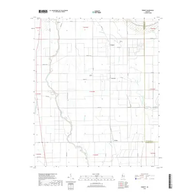
2018 Map of Tribbett
USGS Topo · Published 2018About this map
Tribbett and Bourbon sit at the center of this Mississippi Delta landscape, where the flat alluvial plain is defined by a dense network of drainage sloughs and bayous. The settlement pattern follows the high ground along these waterways, with Tralake positioned to the south near the banks of Bogue Phalia. Agricultural development is evident in the straight-line road network, including Warta Plantation Rd and Kennedy Flat Rd, which cut across the natural meanders of Sixmile Bayou and East Sixmile Bayou. Genealogists will find several significant local landmarks preserved on this sheet, including Bethlehem Cem, Mount Zion Cem, and Kindling Altar Cem. These small, dispersed burial grounds are often the only remaining physical markers of the community centers that once served the rural plantation economy in this part of Washington and Sunflower Counties.
Find a feature on this map
47 named features on this map. Tap any name to fly to it.
Don’t see what you’re looking for? This feature index may not catch every label — zoom into the map to look around manually.
Map Details
Editions of this 2018 Tribbett Map
This is the sole edition of this map. No revisions or reprints were ever made.
Other maps of this area

1939 · Tralake
USGS Topo · 1:62,500

1939 · Swan Lake
USGS Topo · 1:62,500

1940 · Auter
USGS Topo · 1:62,500

1940 · Baird
USGS Topo · 1:62,500

1953 · Greenwood
USGS Topo · 1:250,000

1956 · Greenwood
USGS Topo · 1:250,000

1965 · Indianola
USGS Topo · 1:24,000

1965 · Kinlock
USGS Topo · 1:24,000
1965 · Midnight NW
USGS Topo · 1:24,000

1967 · Baird
USGS Topo · 1:62,500