
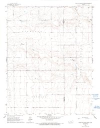
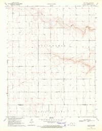
1966 Map of Tribune 4 NE
USGS Topo · Published 1967About this map
Richland and West Hibbard townships characterize this section of the High Plains along the Hamilton and Kearny County line. The landscape is defined by the subtle drainage patterns of James Draw and Mattox Draw, which cut through the high prairie. Human imprint is visible through the rectilinear grid of section lines and a prominent Pipeline traversing the northern reaches of Richland. A remote Landing Strip in the northeast corner and scattered benchmarks like BM 3411 provide navigational points in an area primarily dedicated to agriculture and livestock. This 1960s survey illustrates the specialized land use of the western Kansas borderlands, where water management and transportation infrastructure are vital to the rural economy.
Find a feature on this map
12 named features on this map. Tap any name to fly to it.
Don’t see what you’re looking for? This feature index may not catch every label — zoom into the map to look around manually.
Map Details
Editions of this 1966 Tribune 4 NE Map
2 editions found
Other maps of this area

1955 · Scott City
USGS Topo · 1:250,000

1958 · Scott City
USGS Topo · 1:250,000

1965 · Leoti 3 NW
USGS Topo · 1:24,000

1966 · Tribune 4 NW
USGS Topo · 1:24,000
1966 · Leoti 3 SW
USGS Topo · 1:24,000
1966 · Tribune 4 SE
USGS Topo · 1:24,000
1966 · Tribune 4 SW
USGS Topo · 1:24,000

1970 · Selkirk SW
USGS Topo · 1:24,000

1970 · Selkirk SE
USGS Topo · 1:24,000
1970 · Leoti SW
USGS Topo · 1:24,000