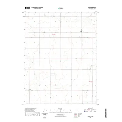
2018 Map of Tribune NW
USGS Topo · Published 2018About this map
Rodgers Cem and Mathews Cem stand as quiet landmarks in this high plains landscape of western Kansas, where the rectilinear geometry of section lines and county roads dictates the movement of people and livestock. This part of Greeley County is defined by the expansive township and range system, specifically within t18s r42w, t18s r41w, t19s r42w, and t19s r41w. The map preserves the names of Walkinghood and Astor, small settlements linked by a network of gravel routes including Co RD O and Co RD P. The terrain is characterized by subtle drainage depressions and livestock ponds that break the steady elevation of the prairie. The sheer number of designated county roads, such as Co RD 6 and Co RD 919, illustrates the methodical division of land for agricultural use in this modern era.
Find a feature on this map
24 named features on this map. Tap any name to fly to it.
Don’t see what you’re looking for? This feature index may not catch every label — zoom into the map to look around manually.
Map Details
Editions of this 2018 Tribune NW Map
This is the sole edition of this map. No revisions or reprints were ever made.
Other maps of this area

1890 · Granada
USGS Topo · 1:125,000

1892 · Cheyenne Wells
USGS Topo · 1:125,000

1892 · Granada
USGS Topo · 1:125,000

1894 · Cheyenne Wells
USGS Topo · 1:125,000

1894 · Granada
USGS Topo · 1:125,000

1954 · Lamar
USGS Topo · 1:250,000

1955 · Scott City
USGS Topo · 1:250,000

1958 · Lamar
USGS Topo · 1:250,000

1958 · Scott City
USGS Topo · 1:250,000
1968 · Towner SE
USGS Topo · 1:24,000