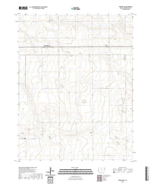
2022 Map of Tribune NW
USGS Topo · Published 2022About this map
High plains terrain in Greeley County characterizes this 2022 survey, where the sparse grid of local roads organizes a landscape of sprawling agricultural sections. Small community clusters at Astor and Walkinghood represent the primary residential footprints in this northern reach of the county, connected by a network of local routes including Co RD P and Co RD 7. For genealogists and local historians, the presence of the Rodgers Cem in the north and Mathews Cem to the southwest provides critical touchpoints for family history research in this rural Kansas quadrangle. The map captures the enduring Public Land Survey System structure, with township lines like t18s r42w and t19s r41w defining the administrative boundaries of the region.
Find a feature on this map
24 named features on this map. Tap any name to fly to it.
Don’t see what you’re looking for? This feature index may not catch every label — zoom into the map to look around manually.
Map Details
Editions of this 2022 Tribune NW Map
This is the sole edition of this map. No revisions or reprints were ever made.
Other maps of this area

1890 · Granada
USGS Topo · 1:125,000

1892 · Cheyenne Wells
USGS Topo · 1:125,000

1892 · Granada
USGS Topo · 1:125,000

1894 · Cheyenne Wells
USGS Topo · 1:125,000

1894 · Granada
USGS Topo · 1:125,000

1954 · Lamar
USGS Topo · 1:250,000

1955 · Scott City
USGS Topo · 1:250,000

1958 · Lamar
USGS Topo · 1:250,000

1958 · Scott City
USGS Topo · 1:250,000
1968 · Towner SE
USGS Topo · 1:24,000