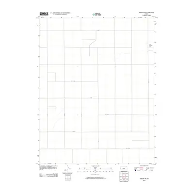
2010 Map of Tribune SW
USGS Topo · Published 2010About this map
Tuttle Landing Field sits on the eastern edge of this high plains landscape, representing a small but vital piece of local aviation history in Greeley County. The terrain is defined by a strictly organized section-line road network, including Co Rd X at the northern boundary and Co Rd EE at the south. These gravel and dirt paths provide the primary structure for the agricultural operations that dominate this portion of the Kansas-Colorado border region.
Find a feature on this map
12 named features on this map. Tap any name to fly to it.
Don’t see what you’re looking for? This feature index may not catch every label — zoom into the map to look around manually.
Map Details
Editions of this 2010 Tribune SW Map
This is the sole edition of this map. No revisions or reprints were ever made.
Other maps of this area

1890 · Granada
USGS Topo · 1:125,000

1892 · Granada
USGS Topo · 1:125,000

1894 · Granada
USGS Topo · 1:125,000

1954 · Lamar
USGS Topo · 1:250,000

1955 · Holly NE
USGS Topo · 1:24,000

1955 · Scott City
USGS Topo · 1:250,000

1958 · Lamar
USGS Topo · 1:250,000

1958 · Scott City
USGS Topo · 1:250,000
1966 · Tribune 3 NE
USGS Topo · 1:24,000
1966 · Tribune 3 NW
USGS Topo · 1:24,000