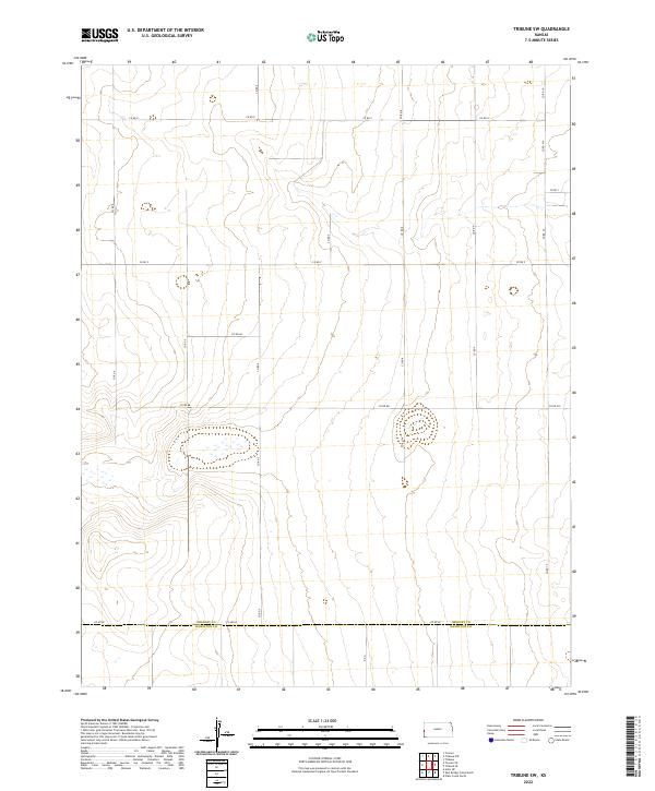
2022 Map of Tribune SW
USGS Topo · Published 2022About this map
The county line between Greeley Co and Hamilton Co defines the southern portion of this High Plains landscape, where the Jeffersonian grid system is etched into the terrain through a meticulous network of section-line roads. This survey reveals a high-altitude agricultural environment characterized by ephemeral wetlands and subtle drainage patterns that reflect the region's semi-arid climate. The infrastructure is almost entirely composed of numbered county routes, such as Co Rd EE and Co Rd BB, which facilitate transport across the large-scale ranching and farming operations typical of western Kansas.
Find a feature on this map
13 named features on this map. Tap any name to fly to it.
Don’t see what you’re looking for? This feature index may not catch every label — zoom into the map to look around manually.
Map Details
Editions of this 2022 Tribune SW Map
This is the sole edition of this map. No revisions or reprints were ever made.
Other maps of this area

1890 · Granada
USGS Topo · 1:125,000

1892 · Granada
USGS Topo · 1:125,000

1894 · Granada
USGS Topo · 1:125,000

1954 · Lamar
USGS Topo · 1:250,000

1955 · Holly NE
USGS Topo · 1:24,000

1955 · Scott City
USGS Topo · 1:250,000

1958 · Lamar
USGS Topo · 1:250,000

1958 · Scott City
USGS Topo · 1:250,000
1966 · Tribune 3 NE
USGS Topo · 1:24,000
1966 · Tribune 3 NW
USGS Topo · 1:24,000