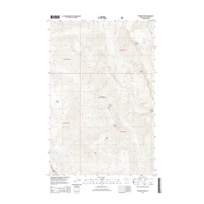
2014 Map of Trilobite Peak
USGS Topo · Published 2014About this map
Flathead National Forest defines the rugged geography of this 2014 survey, where high ridges and deep drainages form a remote wilderness landscape. High points including Trilobite Peak, Pentagon Mtn, and Limestone Peak dominate the topography, while the Trilobite Range provides a central spine through the region. Evidence of historical fire watch and forest management is present at Pot Mountain Lookout on Pot Mtn. The watershed is carved by numerous watercourses such as the Spotted Bear River, Argosy Cr, and Pentagon Cr, with Dean Falls marking a significant drop along Dean Cr. These features, alongside isolated water bodies like Shadow Lake and Pot Lake, illustrate a preserved mountain environment largely unchanged by modern development.
Find a feature on this map
26 named features on this map. Tap any name to fly to it.
Don’t see what you’re looking for? This feature index may not catch every label — zoom into the map to look around manually.
Map Details
Editions of this 2014 Trilobite Peak Map
This is the sole edition of this map. No revisions or reprints were ever made.
Other maps of this area

1913 · Marias Pass
USGS Topo · 1:125,000

1936 · Silvertip
USGS Topo · 1:96,000

1942 · Silvertip
USGS Topo · 1:125,000

1955 · Choteau
USGS Topo · 1:250,000

1957 · Choteau
USGS Topo · 1:250,000

1958 · Choteau
USGS Topo · 1:250,000

1958 · Gable Peaks
USGS Topo · 1:24,000

1958 · Capitol Mountain
USGS Topo · 1:24,000

1960 · Cut Bank
USGS Topo · 1:250,000

1962 · Choteau
USGS Topo · 1:250,000