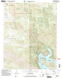
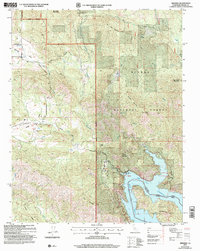
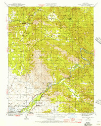
2004 Map of Trimmer
USGS Topo · Published 2007About this map
Pine Flat Reservoir dominates the southeastern quadrant of this Fresno County landscape, where the Kings River is impounded amidst the slopes of the Sierra National Forest and Sequoia National Forest. The settlement of Trimmer sits at the water's edge, serving as a focal point for the mountain community near a designated Boat Ramp and Gaging Station. To the northwest, the terrain transitions into the high valleys and ridges of the Sierra foothills, characterized by the prominent heights of Burrough Mountain and Davis Mountain.
Find a feature on this map
45 named features on this map. Tap any name to fly to it.
Don’t see what you’re looking for? This feature index may not catch every label — zoom into the map to look around manually.
Map Details
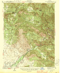
Editions of this 2004 Trimmer Map
2 editions found
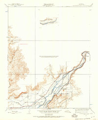
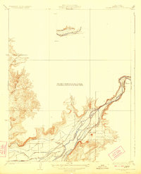
Other maps of this area

1904 · Kaiser
USGS Topo · 1:125,000
1920 · Orangedale School
USGS Topo · 1:24,000

1922 · Trimmer
USGS Topo · 1:96,000
1923 · Orangedale School
USGS Topo · 1:31,680

1924 · Dinuba
USGS Topo · 1:125,000
1942 · Watts Valley
USGS Topo · 1:62,500
1944 · Watts Valley
USGS Topo · 1:62,500

1947 · Mariposa
USGS Topo · 1:250,000

1948 · Fresno
USGS Topo · 1:250,000

1948 · Mariposa
USGS Topo · 1:250,000