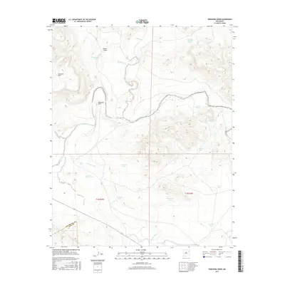
2017 Map of Trinchera Creek
USGS Topo · Published 2017About this map
The Canadian River carves a winding path through this corner of the high plains, defining a landscape dominated by ranching infrastructure and deep drainages. Significant topographic features like Carpenter Mesa and the prominent Horseshoe Bend reflect the erosive power of the river system over time. This 2017 survey reveals the reliance on water management in an arid environment, where a network of named stock ponds and catchment points, including Sink Hole Gap Stock Tank and Government Tank, are distributed across the terrain.
Find a feature on this map
29 named features on this map. Tap any name to fly to it.
Don’t see what you’re looking for? This feature index may not catch every label — zoom into the map to look around manually.
Map Details
Editions of this 2017 Trinchera Creek Map
This is the sole edition of this map. No revisions or reprints were ever made.
Other maps of this area

1930 · Tucumcari
USGS Topo · 1:125,000

1954 · Tucumcari
USGS Topo · 1:250,000

1958 · Tucumcari
USGS Topo · 1:250,000

1967 · Trinchera Creek
USGS Topo · 1:24,000

1967 · Liberty Mesa
USGS Topo · 1:24,000

1967 · Tucumcari
USGS Topo · 1:24,000

1968 · Bascom Camp
USGS Topo · 1:24,000

1968 · Hampton Ranch
USGS Topo · 1:24,000

1968 · Carpenter Mesa SW
USGS Topo · 1:24,000
1968 · Cow Canyon
USGS Topo · 1:24,000