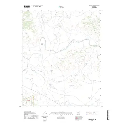
2023 Map of Trinchera Creek
USGS Topo · Published 2023About this map
The Canadian River cuts through the high plains of northeastern New Mexico, defining a landscape of deep canyons and prominent mesas. This modern survey illustrates the rugged drainage systems that feed the river, including Trinchera Creek, Mimosa Creek, and Atarque Creek. The terrain is marked by significant geological features like Carpenter Mesa and the winding Horseshoe Bend, reflecting a topography carved by water in an otherwise arid environment.
Find a feature on this map
25 named features on this map. Tap any name to fly to it.
Don’t see what you’re looking for? This feature index may not catch every label — zoom into the map to look around manually.
Map Details
Editions of this 2023 Trinchera Creek Map
This is the sole edition of this map. No revisions or reprints were ever made.
Other maps of this area

1930 · Tucumcari
USGS Topo · 1:125,000

1954 · Tucumcari
USGS Topo · 1:250,000

1958 · Tucumcari
USGS Topo · 1:250,000

1967 · Trinchera Creek
USGS Topo · 1:24,000

1967 · Liberty Mesa
USGS Topo · 1:24,000

1967 · Tucumcari
USGS Topo · 1:24,000

1968 · Bascom Camp
USGS Topo · 1:24,000

1968 · Hampton Ranch
USGS Topo · 1:24,000

1968 · Carpenter Mesa SW
USGS Topo · 1:24,000
1968 · Cow Canyon
USGS Topo · 1:24,000