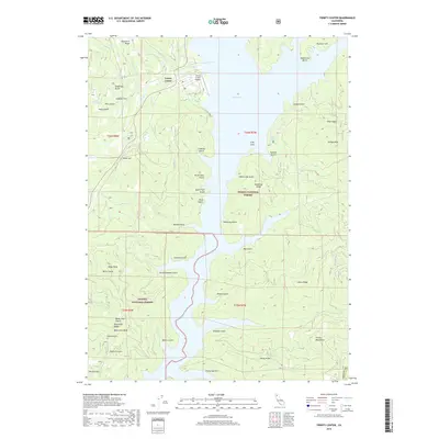
2018 Map of Trinity Center
USGS Topo · Published 2018About this map
Trinity Center and its small aviation field, Trinity Center Airport, anchor the northern reaches of this map where the waters of Trinity Lake fill the surrounding mountain canyons. The landscape is defined by the complex shoreline of the reservoir, which has submerged several former drainage systems and created features like the Irish Isles. Throughout the Shasta National Forest and Trinity National Forest, numerous named gulches like Tough Gus Gulch and Freethy Gulch descend from high ridges toward the lake. The terrain rises sharply from the water to prominent summits including Billys Peak and Jackass Peak. This survey provides a clear look at the region's recreation-oriented layout and its intricate network of creeks, such as Swift Cr and Rancheria Cr, that feed the main body of water.
Find a feature on this map
57 named features on this map. Tap any name to fly to it.
Don’t see what you’re looking for? This feature index may not catch every label — zoom into the map to look around manually.
Map Details
Editions of this 2018 Trinity Center Map
This is the sole edition of this map. No revisions or reprints were ever made.
Other maps of this area

1886 · Shasta
USGS Topo · 1:250,000

1890 · Red Bluff
USGS Topo · 1:250,000

1894 · Red Bluff
USGS Topo · 1:250,000

1894 · Shasta
USGS Topo · 1:250,000

1913 · Weaverville
USGS Topo · 1:125,000

1923 · Sawyers Bar
USGS Topo · 1:125,000

1931 · Etna
USGS Topo · 1:96,000

1934 · Etna
USGS Topo · 1:125,000

1948 · Weed
USGS Topo · 1:250,000

1950 · Weed
USGS Topo · 1:250,000