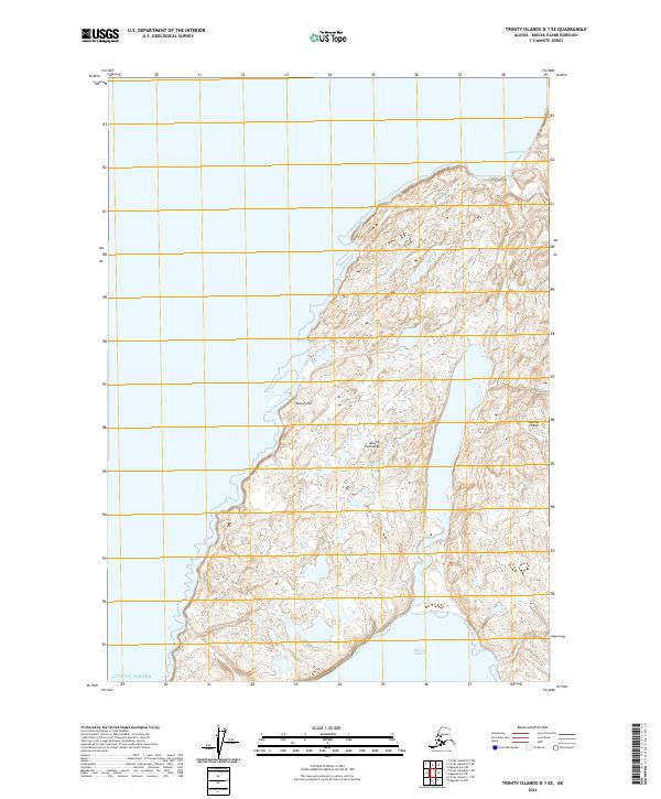
2021 Map of Trinity Islands D-1 SE
USGS Topo · Published 2021About this map
The Aliulik Peninsula defines the coastal character of this portion of Kodiak Island, where land and the Gulf of Alaska meet in a series of deep indentations and rocky points. This 2021 topographic survey documents the intricate shoreline and interior wetlands of the southern reaches of the island. Notable maritime features include the sheltered waters of Humpy Cove to the north and Russian Harbor to the south, separated by the prominent protrusion of Hawk Point. The map provides a precise record of the hydrography and elevation contours across the peninsula, illustrating a landscape shaped by glacial history and oceanic influence, where the absence of roads or settlements underscores the preservation of its natural state in the early twenty-first century.
Find a feature on this map
10 named features on this map. Tap any name to fly to it.
Don’t see what you’re looking for? This feature index may not catch every label — zoom into the map to look around manually.
Map Details
Editions of this 2021 Trinity Islands D-1 SE Map
This is the sole edition of this map. No revisions or reprints were ever made.
Other maps of this area

1951 · Kaguyak
USGS Topo · 1:250,000

1951 · Trinity Islands
USGS Topo · 1:250,000

1952 · Kaguyak
USGS Topo · 1:250,000

1952 · Trinity Islands D-1
USGS Topo · 1:63,360

1952 · Kaguyak D-6
USGS Topo · 1:63,360

1952 · Trinity Islands C-1
USGS Topo · 1:63,360

1954 · Trinity Islands C-1
USGS Topo · 1:63,360
1954 · Trinity Islands D-1
USGS Topo · 1:63,360
1954 · Kaguyak C-6
USGS Topo · 1:63,360
1954 · Kaguyak D-6
USGS Topo · 1:63,360