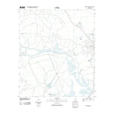
2010 Map of Trinity West
USGS Topo · Published 2010About this map
The Trinity townsite sits at the eastern edge of this landscape, where the local road network converges near the western reaches of the Livingston Reservoir. Further west, the small settlement of Kittrell marks a high point in a terrain defined by the complex drainage systems of the Trinity River valley. This 2010 survey illustrates the significant impact of modern water management on the Texas landscape, showing how the reservoir’s many branches and arms have reshaped the natural flow of the river and its tributaries. The map serves as a detailed record of land use in Trinity County, illustrating the juxtaposition of developed residential areas near the town center and the expansive, water-dominated rural areas that characterize the river basin.
Find a feature on this map
2 named features on this map. Tap any name to fly to it.
Don’t see what you’re looking for? This feature index may not catch every label — zoom into the map to look around manually.
Map Details
Editions of this 2010 Trinity West Map
This is the sole edition of this map. No revisions or reprints were ever made.
Other maps of this area

1953 · Palestine
USGS Topo · 1:250,000

1954 · Beaumont
USGS Topo · 1:250,000

1957 · Beaumont
USGS Topo · 1:250,000

1957 · Palestine
USGS Topo · 1:250,000

1960 · Trinity West
USGS Topo · 1:24,000

1960 · Trinity East
USGS Topo · 1:24,000

1961 · Staley
USGS Topo · 1:24,000

1961 · Riverside
USGS Topo · 1:24,000

1962 · Pine Prairie
USGS Topo · 1:24,000

1962 · Lovelady South
USGS Topo · 1:24,000