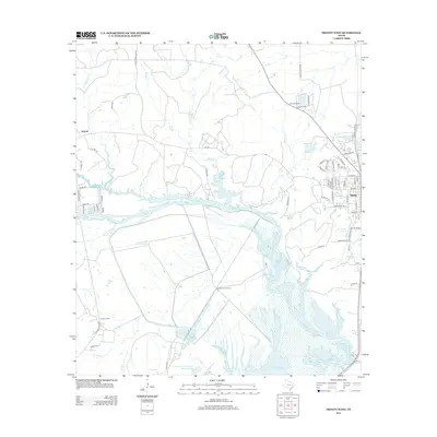
2013 Map of Trinity West
USGS Topo · Published 2013About this map
Livingston Reservoir and its associated wetlands dominate the lower portion of this East Texas survey, where the waters of Village Creek and Turner Creek feed into the large impoundment. The city of Trinity appears on the eastern edge, showing a detailed street grid that includes Main Street, Church Street, and family-named avenues such as Robb Street and Hamilton Avenue. This region is characterized by a mix of agricultural operations and institutional land use, most notably the Smither Prison Farm and the nearby Smither Farm.
Find a feature on this map
71 named features on this map. Tap any name to fly to it.
Don’t see what you’re looking for? This feature index may not catch every label — zoom into the map to look around manually.
Map Details
Editions of this 2013 Trinity West Map
This is the sole edition of this map. No revisions or reprints were ever made.
Other maps of this area

1953 · Palestine
USGS Topo · 1:250,000

1954 · Beaumont
USGS Topo · 1:250,000

1957 · Beaumont
USGS Topo · 1:250,000

1957 · Palestine
USGS Topo · 1:250,000

1960 · Trinity West
USGS Topo · 1:24,000

1960 · Trinity East
USGS Topo · 1:24,000

1961 · Staley
USGS Topo · 1:24,000

1961 · Riverside
USGS Topo · 1:24,000

1962 · Pine Prairie
USGS Topo · 1:24,000

1962 · Lovelady South
USGS Topo · 1:24,000