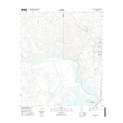
2016 Map of Trinity West
USGS Topo · Published 2016About this map
Lake Livingston dominates the southern reaches of this landscape, its waters backing into the intricate drainages of Turkey Cr and Village Cr. On the eastern edge of the survey, the city of Trinity and the adjacent Mill Town serve as the primary hubs of activity, featuring a tight grid of residential streets like Church St and Elizabeth St. This area reflects the modern configuration of the East Texas piney woods, where large-scale ranching and timber legacies are still visible in names like the Eastham and Thomason Ranches Lake. To the north, the terrain rises into hills divided by Chalk Cr and Dillard Creek, where Chalk Cemetery Rd provides a link to local genealogy. Small water bodies and impoundments, such as Ellis Reservoir and Lake Jennifer, are scattered throughout, illustrating how water management shaped the rural homesteads and industries of Trinity County.
Find a feature on this map
58 named features on this map. Tap any name to fly to it.
Don’t see what you’re looking for? This feature index may not catch every label — zoom into the map to look around manually.
Map Details
Editions of this 2016 Trinity West Map
This is the sole edition of this map. No revisions or reprints were ever made.
Other maps of this area

1953 · Palestine
USGS Topo · 1:250,000

1954 · Beaumont
USGS Topo · 1:250,000

1957 · Beaumont
USGS Topo · 1:250,000

1957 · Palestine
USGS Topo · 1:250,000

1960 · Trinity West
USGS Topo · 1:24,000

1960 · Trinity East
USGS Topo · 1:24,000

1961 · Staley
USGS Topo · 1:24,000

1961 · Riverside
USGS Topo · 1:24,000

1962 · Pine Prairie
USGS Topo · 1:24,000

1962 · Lovelady South
USGS Topo · 1:24,000