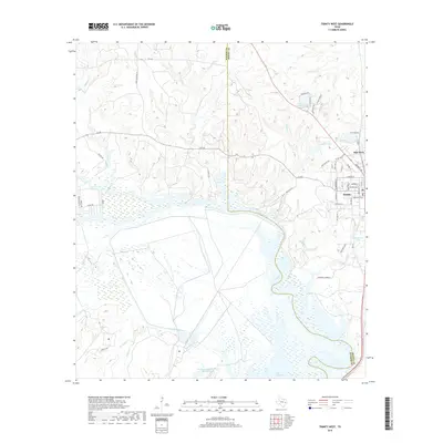
2019 Map of Trinity West
USGS Topo · Published 2019About this map
Trinity serves as a local hub near the boundary between Walker and Trinity counties, where the street grid transitions into the river valley landscape. The Trinity River and the northern reaches of Lake Livingston dominate the southern half of the area, defining a complex system of sloughs and water bodies including Thornton Lake and Haraldson Lake. To the north, the terrain rises into more dissected country drained by Turkey Creek and Dillard Creek, where local landmarks like the Chalk Cemetery and Eastham and Thomason Ranches Lake reflect longstanding land use patterns.
Find a feature on this map
58 named features on this map. Tap any name to fly to it.
Don’t see what you’re looking for? This feature index may not catch every label — zoom into the map to look around manually.
Map Details
Editions of this 2019 Trinity West Map
This is the sole edition of this map. No revisions or reprints were ever made.
Other maps of this area

1953 · Palestine
USGS Topo · 1:250,000

1954 · Beaumont
USGS Topo · 1:250,000

1957 · Beaumont
USGS Topo · 1:250,000

1957 · Palestine
USGS Topo · 1:250,000

1960 · Trinity West
USGS Topo · 1:24,000

1960 · Trinity East
USGS Topo · 1:24,000

1961 · Staley
USGS Topo · 1:24,000

1961 · Riverside
USGS Topo · 1:24,000

1962 · Pine Prairie
USGS Topo · 1:24,000

1962 · Lovelady South
USGS Topo · 1:24,000