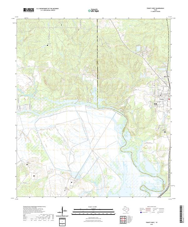
2022 Map of Trinity West
USGS Topo · Published 2022About this map
The Trinity River and the expansive Lake Livingston dominate this East Texas landscape at the border of Walker and Trinity counties. The settlement of Trinity serves as a local hub, surrounded by a high concentration of burial grounds including Cedar Grove Cem, Trinity Black Cem - West, and Trinity Black Cem - East. To the north, Mill Town and Sentell Lake mark the transition toward the creek-fed uplands of Dillard Cr and Turkey Cr.
Find a feature on this map
72 named features on this map. Tap any name to fly to it.
Don’t see what you’re looking for? This feature index may not catch every label — zoom into the map to look around manually.
Map Details
Editions of this 2022 Trinity West Map
This is the sole edition of this map. No revisions or reprints were ever made.
Other maps of this area

1953 · Palestine
USGS Topo · 1:250,000

1954 · Beaumont
USGS Topo · 1:250,000

1957 · Beaumont
USGS Topo · 1:250,000

1957 · Palestine
USGS Topo · 1:250,000

1960 · Trinity West
USGS Topo · 1:24,000

1960 · Trinity East
USGS Topo · 1:24,000

1961 · Staley
USGS Topo · 1:24,000

1961 · Riverside
USGS Topo · 1:24,000

1962 · Pine Prairie
USGS Topo · 1:24,000

1962 · Lovelady South
USGS Topo · 1:24,000