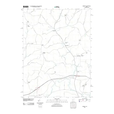
2010 Map of Trinway
USGS Topo · Published 2010About this map
Wakatomika Creek and its tributary Little Wakatomika Creek carve through the landscape of Muskingum and Coshocton Counties, defining the drainage patterns of this rural Ohio region. The settlement of Trinway sits at the southern edge of this study, served by the Trinway Post Office, while the small village of West Carlisle anchors the northwest. This 2010 survey highlights a significant concentration of early religious and burial sites, including the Chalfant Meeting House Cemetery and Tomika Regular Baptist Cemetery, which provide critical reference points for local genealogists.
Find a feature on this map
78 named features on this map. Tap any name to fly to it.
Don’t see what you’re looking for? This feature index may not catch every label — zoom into the map to look around manually.
Map Details
Editions of this 2010 Trinway Map
This is the sole edition of this map. No revisions or reprints were ever made.
Other maps of this area

1908 · Conesville
USGS Topo · 1:62,500

1910 · Frazeysburg
USGS Topo · 1:62,500

1910 · Conesville
USGS Topo · 1:62,500

1913 · Brinkhaven
USGS Topo · 1:62,500

1913 · Coshocton
USGS Topo · 1:62,500

1915 · Brinkhaven
USGS Topo · 1:62,500

1915 · Coshocton
USGS Topo · 1:62,500

1943 · Coshocton
USGS Topo · 1:62,500

1950 · Marion
USGS Topo · 1:250,000

1951 · Canton
USGS Topo · 1:250,000