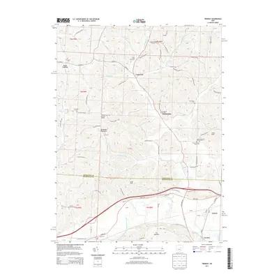
2013 Map of Trinway
USGS Topo · Published 2013About this map
Wakatomika Creek and the Muskingum River converge in this corner of Ohio, defining a landscape of deep-cut ridges and agricultural valleys. The 2013 survey illustrates the enduring rural character of the border between Coshocton and Muskingum counties, where settlements like Trinway and Dresden sit near the riverbanks. The region is notable for its numerous small rural cemeteries, including the Broomstick Cem and the Chalfant Meeting House Cem, which point to generations of family settlement on high ground such as Graham Ridge and Irish Ridge. Inland from the river, the terrain is shaped by numerous tributaries like Sand Fork and Little Wakatomika Cr, which dictated the winding paths of the township road network. Significant local landmarks such as the Hill N Dale Dairy Farm and Indian Knob provide concrete markers for the area's agricultural and geographic identity.
Find a feature on this map
95 named features on this map. Tap any name to fly to it.
Don’t see what you’re looking for? This feature index may not catch every label — zoom into the map to look around manually.
Map Details
Editions of this 2013 Trinway Map
This is the sole edition of this map. No revisions or reprints were ever made.
Other maps of this area

1908 · Conesville
USGS Topo · 1:62,500

1910 · Frazeysburg
USGS Topo · 1:62,500

1910 · Conesville
USGS Topo · 1:62,500

1913 · Brinkhaven
USGS Topo · 1:62,500

1913 · Coshocton
USGS Topo · 1:62,500

1915 · Brinkhaven
USGS Topo · 1:62,500

1915 · Coshocton
USGS Topo · 1:62,500

1943 · Coshocton
USGS Topo · 1:62,500

1950 · Marion
USGS Topo · 1:250,000

1951 · Canton
USGS Topo · 1:250,000