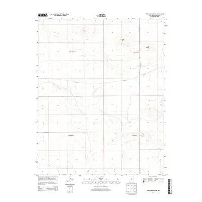
2013 Map of Tripod Mountain
USGS Topo · Published 2013About this map
Tripod Mtn and Chavez Mtn dominate this section of northeastern New Mexico, where volcanic landforms rise abruptly from the high plains. The landscape is defined by its drainage patterns, with Carrizo Cr and Cedar Cr cutting through the terrain. Human activity is centered on a sparse but vital network of county infrastructure, including Sofia Rd and Co Highway A-007, which navigate the elevation changes created by The Hogback. The map captures a moment in the early twenty-first century when the region remained dedicated to open-range ranching and large-scale land management, as evidenced by the clear township and range lines marking the Public Land Survey System boundaries across the territory.
Find a feature on this map
13 named features on this map. Tap any name to fly to it.
Don’t see what you’re looking for? This feature index may not catch every label — zoom into the map to look around manually.
Map Details
Editions of this 2013 Tripod Mountain Map
This is the sole edition of this map. No revisions or reprints were ever made.
Other maps of this area

1954 · Dalhart
USGS Topo · 1:250,000

1958 · Dalhart
USGS Topo · 1:250,000

1962 · Dalhart
USGS Topo · 1:250,000

1972 · Cow Mountain
USGS Topo · 1:24,000

1973 · Grenville SW
USGS Topo · 1:24,000

1973 · Snyder Lake
USGS Topo · 1:24,000

1973 · Tripod Mountain
USGS Topo · 1:24,000

1973 · Sofia
USGS Topo · 1:24,000

1973 · Romero Spring
USGS Topo · 1:24,000
1973 · Goat Canyon
USGS Topo · 1:24,000