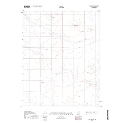
2023 Map of Tripod Mountain
USGS Topo · Published 2023About this map
Tripod Mountain and Chavez Mountain dominate this northeastern New Mexico landscape, characterized by high-elevation mesas and volcanic landforms. The terrain is defined by the drainage patterns of Carrizo Creek and Cedar Creek, which carve through the high plains of Union County. The 2023 survey illustrates a sparsely populated ranching environment where the movement of people and livestock is facilitated by a network of county roads including Sofia Rd, Cedar Creek Rd, and Co Rd A115. A prominent geological feature known as The Hogback sits in the eastern portion of the quadrangle, marking a distinct ridge line common to the region's sedimentary and volcanic history. The map's township and range markers, such as t26n r31e, provide essential data for modern land management and historical property research in this open range country.
Find a feature on this map
14 named features on this map. Tap any name to fly to it.
Don’t see what you’re looking for? This feature index may not catch every label — zoom into the map to look around manually.
Map Details
Editions of this 2023 Tripod Mountain Map
This is the sole edition of this map. No revisions or reprints were ever made.
Other maps of this area

1954 · Dalhart
USGS Topo · 1:250,000

1958 · Dalhart
USGS Topo · 1:250,000

1962 · Dalhart
USGS Topo · 1:250,000

1972 · Cow Mountain
USGS Topo · 1:24,000

1973 · Grenville SW
USGS Topo · 1:24,000

1973 · Snyder Lake
USGS Topo · 1:24,000

1973 · Tripod Mountain
USGS Topo · 1:24,000

1973 · Sofia
USGS Topo · 1:24,000

1973 · Romero Spring
USGS Topo · 1:24,000
1973 · Goat Canyon
USGS Topo · 1:24,000