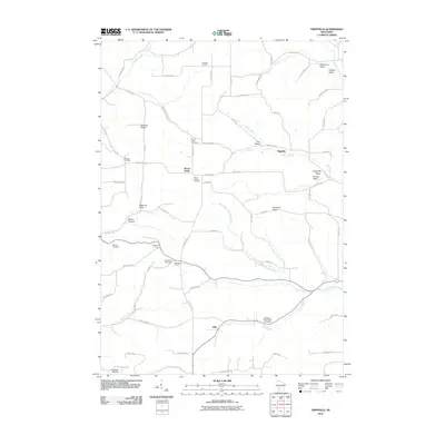
2010 Map of Trippville
USGS Topo · Published 2010About this map
Trippville and Mount Tabor anchor this rural landscape in the Driftless Area, where the drainage of the West Branch Baraboo River and Hills Creek defines the local topography. This early 21st-century survey reveals a patchwork of small communities and crossroads like Sutcliffe Corners and Bartons Corners. The map provides a detailed view of local heritage through its numerous burial grounds, including the Bohemian Brotherhood Cemetery and the Saint Joseph Cemetery near Mount Tabor. The terrain is marked by distinctive family-named features such as Schumann Valley, Stelting Ridge, and Barton Hollow, illustrating the enduring nature of local landownership. At the southern edge, the 0.22 Reservoir and Herbeck H 208 Dam manage the flow of Warner Creek, contrasting the natural stream paths that wind through Durkee Valley and Cox Valley.
Find a feature on this map
71 named features on this map. Tap any name to fly to it.
Don’t see what you’re looking for? This feature index may not catch every label — zoom into the map to look around manually.
Map Details
Editions of this 2010 Trippville Map
This is the sole edition of this map. No revisions or reprints were ever made.
Other maps of this area

1916 · Tomah
USGS Topo · 1:62,500

1919 · Kendall
USGS Topo · 1:62,500

1921 · Kendall
USGS Topo · 1:62,500

1926 · La Farge
USGS Topo · 1:62,500

1927 · Hillsboro
USGS Topo · 1:62,500

1949 · Tomah
USGS Topo · 1:62,500

1958 · La Crosse
USGS Topo · 1:250,000

1961 · La Crosse
USGS Topo · 1:250,000

1962 · Kendall
USGS Topo · 1:62,500

1965 · La Crosse
USGS Topo · 1:250,000