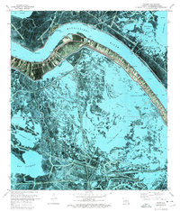
1971 Map of Triumph
USGS Topo · Published 1974About this map
The Mississippi River creates a sharp oxbow at Fort Jackson and Fort St Philip, where military history and the delta's hydraulic engineering meet. This 1971 orthophotomap illustrates the concentrated ribbon of development along the river's high ground, featuring the community of Triumph and the combined settlements of Boothville and Olga. The landscape is dominated by a complex network of marshes and water bodies including Carrion Crow Bay and Yellow Cotton Bay, intersected by the Jurjevich Canal. Cultural markers like the Boothville Cem and Mt Olive Ch are tucked between the levee and the encroaching wetlands. Beyond the protective levees, the map reveals a landscape of industrial activity with numerous Oil Wells and a Sewage Disposal plant, highlighting the region's role in resource extraction and coastal management.
Find a feature on this map
47 named features on this map. Tap any name to fly to it.
Don’t see what you’re looking for? This feature index may not catch every label — zoom into the map to look around manually.
Map Details
Editions of this 1971 Triumph Map
2 editions found
Other maps of this area

1892 · Quarantine
USGS Topo · 1:62,500

1893 · Forts
USGS Topo · 1:62,500

1893 · West Delta
USGS Topo · 1:62,500

1935 · Taylor Pass
USGS Topo · 1:31,680

1935 · Tropical Bend
USGS Topo · 1:31,680

1941 · Empire
USGS Topo · 1:62,500

1944 · Empire
USGS Topo · 1:62,500

1946 · Pass Tante Phine
USGS Topo · 1:31,680

1947 · Buras
USGS Topo · 1:31,680

1947 · Venice
USGS Topo · 1:31,680