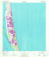
1949 Map of Tropic
USGS Topo · Published 1972About this map
Patrick Air Force Base dominates the northern reaches of this coastal survey, highlighting the significant military presence along the Space Coast during the mid-20th century. Situated on the barrier island between the Banana River and the Atlantic Ocean, the map documents the rapid expansion of residential areas through purple-tinted updates. Settlements like South Patrick, Satellite Beach, and Indian Harbour Beach illustrate the post-war development boom that transformed this narrow strip of land. Across the Indian River on Merritt Island, smaller landmarks such as the Drive-in Theater and the community of Tropic provide a more local perspective of the era's landscape. The inclusion of the Intracoastal Waterway and the Eau Gallie Bridge emphasizes the importance of maritime and automotive connectivity for these growing beach communities.
Find a feature on this map
25 named features on this map. Tap any name to fly to it.
Don’t see what you’re looking for? This feature index may not catch every label — zoom into the map to look around manually.
Map Details
Editions of this 1949 Tropic Map
4 editions found
Other maps of this area

1949 · Melbourne West
USGS Topo · 1:24,000

1949 · Melbourne East
USGS Topo · 1:24,000

1949 · Eau Gallie
USGS Topo · 1:24,000

1949 · Cocoa
USGS Topo · 1:24,000

1949 · Cocoa Beach
USGS Topo · 1:24,000

1949 · Tropic
USGS Topo · 1:24,000

1951 · Melbourne East
USGS Topo · 1:24,000

1951 · Eau Gallie
USGS Topo · 1:24,000

1951 · Cocoa
USGS Topo · 1:24,000

1951 · Melbourne West
USGS Topo · 1:24,000