
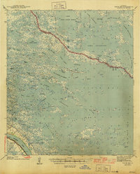
1935 Map of Tropical Bend
USGS Topo · Published 1935About this map
The Mississippi River dominates this mid-1930s landscape, flanked by a complex network of levees and man-made waterways like the Doullut Canal and Johnson Canal. These channels were essential for navigating the marshy environment of Plaquemines Parish, connecting the river to expansive coastal waters such as Quarantine Bay and Adams Bay. The settlement at Empire and the landmark of Tropical Bend show a narrow ribbon of development pressed against the river's eastern bank, served by the Louisiana Southern Railroad and State Highway No 31.
Find a feature on this map
46 named features on this map. Tap any name to fly to it.
Don’t see what you’re looking for? This feature index may not catch every label — zoom into the map to look around manually.
Map Details
Editions of this 1935 Tropical Bend Map
This is the sole edition of this map. No revisions or reprints were ever made.
Other maps of this area

1892 · Quarantine
USGS Topo · 1:62,500

1893 · La Fortuna
USGS Topo · 1:62,500

1893 · Forts
USGS Topo · 1:62,500

1893 · Dime
USGS Topo · 1:62,500

1935 · Port Sulphur
USGS Topo · 1:31,680

1935 · Bastian Bay
USGS Topo · 1:31,680

1941 · Black Bay
USGS Topo · 1:62,500

1941 · Empire
USGS Topo · 1:62,500
1944 · Black Bay
USGS Topo · 1:62,500

1944 · Empire
USGS Topo · 1:62,500