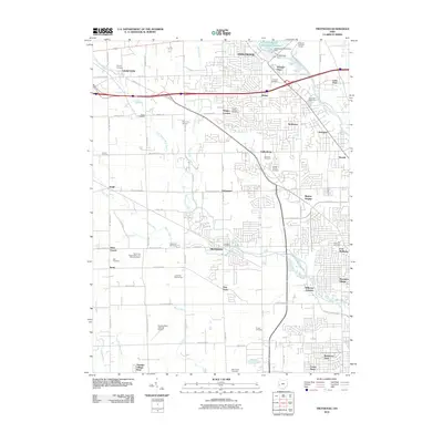
2010 Map of Trotwood
USGS Topo · Published 2010About this map
Wolf Creek and its many tributaries, including Poplar Run and Moss Creek, define the topography of this Montgomery County landscape. In the north, the Englewood Dam and the Englewood Recreation Reservoir represent significant water management infrastructure along the Stillwater River. The area is characterized by a dense network of suburban development and historical crossroads, where smaller communities like Happy Corners, Kinsey, and Taylorsburg sit alongside the larger hubs of Trotwood and Englewood.
Find a feature on this map
88 named features on this map. Tap any name to fly to it.
Don’t see what you’re looking for? This feature index may not catch every label — zoom into the map to look around manually.
Map Details
Editions of this 2010 Trotwood Map
This is the sole edition of this map. No revisions or reprints were ever made.
Other maps of this area

1904 · Dayton
USGS Topo · 1:62,500

1905 · Brookville
USGS Topo · 1:62,500

1906 · Dayton
USGS Topo · 1:62,500

1908 · Miamisburg
USGS Topo · 1:62,500

1913 · Waynesville
USGS Topo · 1:62,500

1915 · Waynesville
USGS Topo · 1:62,500

1953 · Cincinnati
USGS Topo · 1:250,000

1955 · Miamisburg
USGS Topo · 1:24,000

1955 · Dayton South
USGS Topo · 1:24,000

1955 · West Milton
USGS Topo · 1:24,000