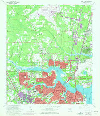
1964 Map of Trout River
USGS Topo · Published 1972About this map
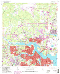
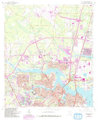
Jacksonville International Airport and the sprawling waterways of the Trout River define this North Jacksonville landscape during a period of rapid suburban and industrial expansion. The map illustrates a complex network of established neighborhoods and emerging developments, including Sherwood Forest, Highlands, and Riverview. The St Johns River anchors the southeast corner, where the U S Naval Reservation and Panama Park sit near the confluence with the Trout River. Heavy infrastructure is prominent, from the Seaboard Coast Line and Southern Railway tracks to the massive footprint of the older Imeson Airport. Cultural landmarks like the Jacksonville Zoo and numerous neighborhood schools and churches, such as Ribault High Sch and St Pauls Ch, reflect the community's growth. The transition from tidal flats and marshes to organized residential blocks like Lake Forest Hills and Harbor View captures the mid-century push toward the coast.
Find a feature on this map
76 named features on this map. Tap any name to fly to it.
Don’t see what you’re looking for? This feature index may not catch every label — zoom into the map to look around manually.
Map Details
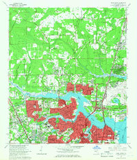
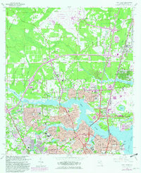
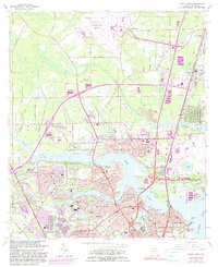
Editions of this 1964 Trout River Map
6 editions found
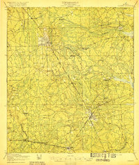
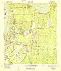
Other maps of this area

1917 · Cambon
USGS Topo · 1:62,500

1917 · Hilliard
USGS Topo · 1:62,500

1918 · St Marys
USGS Topo · 1:62,500

1918 · Cambon
USGS Topo · 1:62,500

1918 · Jacksonville
USGS Topo · 1:62,500

1919 · St Marys
USGS Topo · 1:62,500
1919 · Hilliard
USGS Topo · 1:62,500

1948 · Jacksonville
USGS Topo · 1:250,000

1948 · Eastport
USGS Topo · 1:24,000
1950 · Arlington
USGS Topo · 1:24,000
Featured Places
- Jacksonville, FL
- Lake Park Estates, Jacksonville
- Lake Forest Manor, Jacksonville
- Garden City, Jacksonville
- Oakhurst, Jacksonville