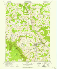
1957 Map of Troy
USGS Topo · Published 1958About this map
Troy serves as a central hub for Bradford County agriculture and commerce in the late 1950s, situated where the Pennsylvania railroad meets the Roosevelt Highway. This survey reveals a landscape of high ridges and narrow valleys, defined by the rise of Armenia Mountain to the southwest and Oak Hill to the east. The drainage pattern is complex, with waters flowing through Sugar Creek and the North Branch Pennsylvania Creek, carving deep features like Case Glen. The presence of numerous family-named cemeteries, such as Besley Cem, Fries Cem, and the Granite-Pierson Cem, indicates a deeply rooted rural population. Smaller clusters of activity are visible at Columbia Cross Roads and Austinville, while local education is anchored by the High Sch, Lloyd Sch, and Croman Sch. Near the borough center, Alparon Park and the Troy Reservoir mark the community's established infrastructure.
Find a feature on this map
59 named features on this map. Tap any name to fly to it.
Don’t see what you’re looking for? This feature index may not catch every label — zoom into the map to look around manually.
Map Details
Editions of this 1957 Troy Map
2 editions found
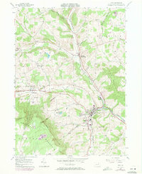
Other maps of this area

1931 · Troy
USGS Topo · 1:48,000

1938 · Troy
USGS Topo · 1:62,500

1939 · Sayre
USGS Topo · 1:62,500

1942 · Sayre
USGS Topo · 1:62,500

1942 · Canton
USGS Topo · 1:62,500

1943 · Powell
USGS Topo · 1:62,500

1944 · Canton
USGS Topo · 1:62,500

1945 · Powell
USGS Topo · 1:62,500

1948 · Sayre
USGS Topo · 1:62,500

1953 · Roseville
USGS Topo · 1:24,000