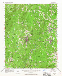
1957 Map of Troy
USGS Topo · Published 1967About this map
Troy and Biscoe serve as central hubs in this mid-century portrait of Montgomery County, where the industrial presence of the Norfolk Southern railroad connects timber and textile communities. The landscape is defined by the winding course of the Little River and Rocky River, which carved through a region once dotted with small-scale extraction and institutional footprints. To the north, the Black Ankle Mine and the State Prison Camp 804 indicate the diverse use of the land beyond traditional farming.
Find a feature on this map
97 named features on this map. Tap any name to fly to it.
Don’t see what you’re looking for? This feature index may not catch every label — zoom into the map to look around manually.
Map Details
Editions of this 1957 Troy Map
2 editions found

Other maps of this area

1942 · Troy
USGS Topo · 1:125,000

1949 · Jackson Springs
USGS Topo · 1:62,500

1950 · Norman
USGS Topo · 1:24,000

1953 · Raleigh
USGS Topo · 1:250,000

1953 · Charlotte
USGS Topo · 1:250,000

1954 · Charlotte
USGS Topo · 1:250,000

1954 · Raleigh
USGS Topo · 1:250,000

1956 · Mount Gilead East
USGS Topo · 1:24,000

1956 · Harrisville
USGS Topo · 1:24,000

1956 · Mount Gilead West
USGS Topo · 1:24,000