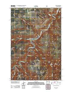
2011 Map of Troy
USGS Topo · Published 2011About this map
The confluence of the Wenaha River and the Grande Ronde River anchors the small settlement of Troy, located at a critical river junction in this corner of the Pacific Northwest. The landscape is defined by high plateaus and deep incisions, where upland features like Grouse Flat and Powwatka Ridge provide space for isolated communities such as Bartlett and Grouse. A network of winding mountain roads, including Grouse Flat Rd and Troy Rd, connects these remote outposts across the steep terrain of Squaw Canyon and Lower Trail Canyon. Local history and genealogy are anchored at the Bartlett Cemetery, while several springs like Dan Cold Spring and Colpitts Spring mark reliable water sources in the rugged back-country. The transition from the high ridges of Eden Ridge to the river bottoms illustrates the traditional land use patterns of Wallowa County, where settlement is dictated by the dramatic topography of the canyonlands.
Find a feature on this map
35 named features on this map. Tap any name to fly to it.
Don’t see what you’re looking for? This feature index may not catch every label — zoom into the map to look around manually.
Map Details
Editions of this 2011 Troy Map
This is the sole edition of this map. No revisions or reprints were ever made.
Other maps of this area

1937 · Pomeroy
USGS Topo · 1:96,000

1942 · Pomeroy
USGS Topo · 1:125,000

1943 · Saddle Butte
USGS Topo · 1:62,500

1946 · Saddle Butte
USGS Topo · 1:62,500

1955 · Pullman
USGS Topo · 1:250,000

1955 · Grangeville
USGS Topo · 1:250,000

1958 · Pullman
USGS Topo · 1:250,000

1959 · Grangeville
USGS Topo · 1:250,000

1967 · Wood Butte
USGS Topo · 1:24,000

1967 · Troy
USGS Topo · 1:24,000