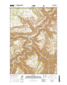
2017 Map of Troy
USGS Topo · Published 2017About this map
The confluence of the Wenaha River and the Grande Ronde River anchors this corner of the Pacific Northwest, where the borders of Oregon and Washington meet. High plateau terrain is defined by dramatic vertical relief, from the Bartlett Bench and Lightle Flat down into deeply incised canyons like Whitmore Canyon and Shuman Canyon. The small settlements of Bartlett and Troy serve as the primary human centers in an area otherwise dominated by the timber and wildlife of the Umatilla National Forest.
Find a feature on this map
52 named features on this map. Tap any name to fly to it.
Don’t see what you’re looking for? This feature index may not catch every label — zoom into the map to look around manually.
Map Details
Editions of this 2017 Troy Map
This is the sole edition of this map. No revisions or reprints were ever made.
Other maps of this area

1937 · Pomeroy
USGS Topo · 1:96,000

1942 · Pomeroy
USGS Topo · 1:125,000

1943 · Saddle Butte
USGS Topo · 1:62,500

1946 · Saddle Butte
USGS Topo · 1:62,500

1955 · Pullman
USGS Topo · 1:250,000

1955 · Grangeville
USGS Topo · 1:250,000

1958 · Pullman
USGS Topo · 1:250,000

1959 · Grangeville
USGS Topo · 1:250,000

1967 · Wood Butte
USGS Topo · 1:24,000

1967 · Troy
USGS Topo · 1:24,000