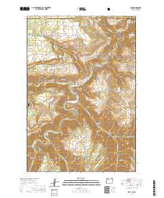
2020 Map of Troy
USGS Topo · Published 2020About this map
Troy sits at the confluence of the Wenaha River and the Grande Ronde River, serving as a focal point for this mountain landscape on the Oregon and Washington border. The map reveals a remote network of upland ridges and deep canyons, including Ioxsawkt Canyon and Shuman Canyon, which define the topography between the Umatilla National Forest and the high plateaus of Bartlett Bench and Day Ridge. Settled pockets like Bartlett and Grouse Flat are connected by winding roads such as Grouse Flat Rd and Troy Rd, illustrating the dispersed nature of local ranching or homesteading life.
Find a feature on this map
53 named features on this map. Tap any name to fly to it.
Don’t see what you’re looking for? This feature index may not catch every label — zoom into the map to look around manually.
Map Details
Editions of this 2020 Troy Map
This is the sole edition of this map. No revisions or reprints were ever made.
Other maps of this area

1937 · Pomeroy
USGS Topo · 1:96,000

1942 · Pomeroy
USGS Topo · 1:125,000

1943 · Saddle Butte
USGS Topo · 1:62,500

1946 · Saddle Butte
USGS Topo · 1:62,500

1955 · Pullman
USGS Topo · 1:250,000

1955 · Grangeville
USGS Topo · 1:250,000

1958 · Pullman
USGS Topo · 1:250,000

1959 · Grangeville
USGS Topo · 1:250,000

1967 · Wood Butte
USGS Topo · 1:24,000

1967 · Troy
USGS Topo · 1:24,000